


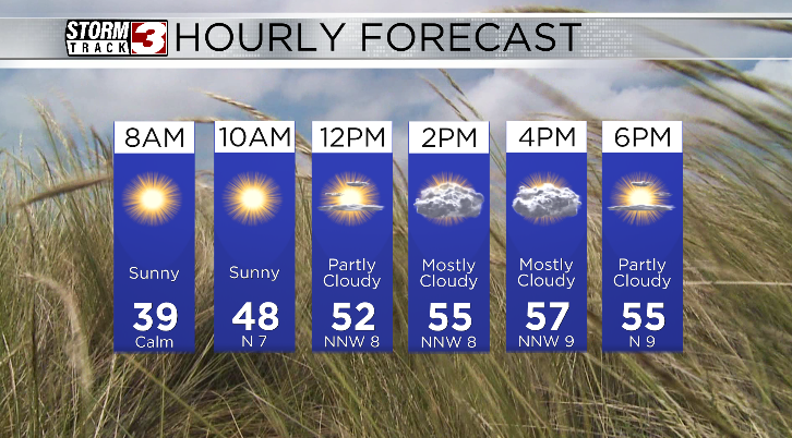
WSIL(Carterville, IL)--It's another bitterly cold morning for most of us with temperatures in the low to mid 30s. Thankfully, we are not seeing any gusty winds across the area, so windchill values are the same as the actual air temperatures.
Today, you can expect to see temperatures vary quite a bit across the region once again. Highs across southern Illinois, where we could see a little more in the way of cloud cover, could be in the mid 50s. However, where the cloud cover is less across southeastern Missouri, we could see highs in the upper 50s and lower 60s.

Tomorrow, we will once again see near freezing temperatures for the morning. For this reason, there is a freeze warning in effect through 8:00 am Saturday for our northern counties, and a frost advisory for our most of us, also through 8:00 am Saturday.
Highs tomorrow will be in the upper 50s and low 60s across the region. We will see some cloud cover in the morning before skies become mostly sunny in the afternoon.
We will see scattered storms in the afternoon on Sunday, but we will be dry and partly cloudy for eclipse day.