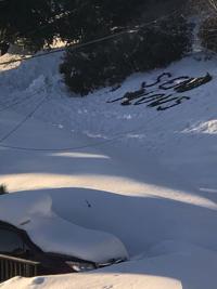

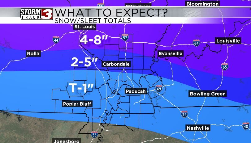

CARTERVILLE, Ill. (WSIL) -- The major winter storm is upon us and bringing with it all types of precipitation, gusty winds and bitter cold temperatures.

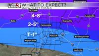
With the freezing rain, sleet and snow, road conditions are expected to be hazardous. Motorists are highly discouraged from driving on hazardous road conditions.
Southeast Missouri should start seeing precipitation as early as 10 a.m. on Saturday night. Southern Illinois and western Kentucky counties could start seeing precipitation as early as midnight on Sunday morning. Although, a band or two of snow has moved through late Saturday night which brought some flurries.
Isolated to scattered power outages are possible. Winds are expected to be 15 - 20 mph with gusts up to 30 mph.
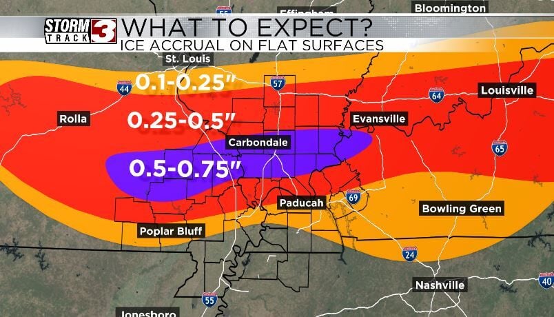
The National Weather Service states this could be a "major to locally historic ice storm possible." Ice accumulations are forecasted to be .25 inches to .75 inches with some areas seeing as much as an inch.
Authorities urge you to check on neighbors and family, properly ventilate emergency heat sources, keep generators at least 20 feet from your home and take it easy when you are shoveling.