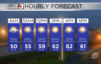


WSIL(Carterville, Ill.)-- It's quite a chilly morning! A lot of us are waking up to temperatures in the lower 50s, and a few locations are in the upper 40s, maily in our northernmost counties.
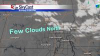
Today, you can expect to see partly cloudy skies with temperatures that will be in the low to mid 60s this afternoon. Thankfully, we are done with the chances of severe weather, and with chances for showers this afternoon, thanks to the cold front. We could see breezy conditions early this morning with peak wind gusts possibly as high as 25 miles per hour.
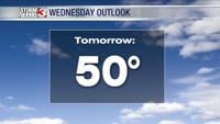
This weekend, we will see cooler temperatures. Morning lows tomorrow will be in the low 40s, and we could see some frost for Sunday morning with temperatures in the lower 40s and upper 30s. Highs both days will be in the low 60s and upper 50s. Sunday should be the cooler day. Both days will be partly cloudy with dry conditions.
Rain won't return until Tuesday and Wednesday when showers enter the area.