WSIL -- Moving at a snail's pace, a persistent pattern will bring more slow moving scattered storms Thursday.
An upper-level low is camped over the area right now, and more storms will develop during the heat of the day and swirl around this disturbance.
With little to no movement in the atmosphere, storms will likely move very slowly and even drift "backwards" from east to west.
Due to the slow movement, any storms that develop could pose a threat for localized flash flooding.
Reminder: Do NOT drive through flood waters!
Viewers passed along photos of tropical funnels that occurred Wednesday in Hamilton, White, and Gallatin counties and more are possible Thursday afternoon. These funnels are NOT tornadoes and typically do not touch down to the ground. Generally, they're harmless.
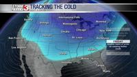
Meteorologist Nick Hausen is tracking a cold front that will finally break this stubborn pattern. Join him on News 3 This Morning to find out when that break will arrive!


