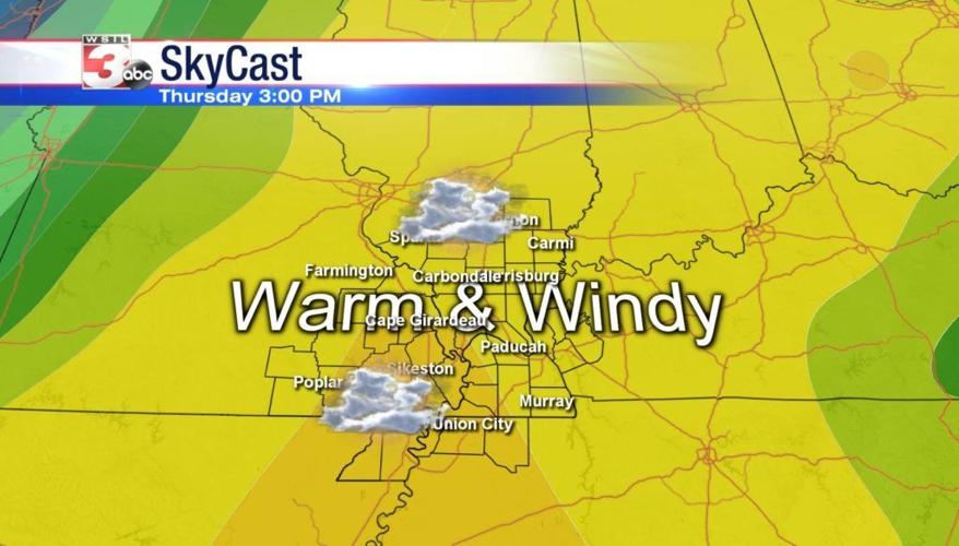


WSIL �� It was another beautiful day with temperatures topping out in the upper 70s and low 80s. Unfortunately, much cooler temperatures are on the way.
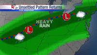
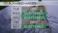
Thursday, our next strong storm system begins to move into the area. Ahead of this system, winds will be out of the south with gusts near 40 miles per hour possible. The front will move in from the west Thursday evening bringing the chances for showers and thunderstorms. Isolated strong storms will be a possibility with damaging winds as the main threat.
Much cooler temperatures will set in behind the front leading to a chilly end to the week and weekend.
The next chance for rain will return Saturday evening and into Sunday with the chance for heavy rainfall. It’s looking like a chilly and soggy weekend.
Meteorologist Nick Hausen will have the latest update tomorrow on News 3.