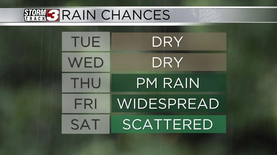


CARTERVILLE Ill (WSIL) -- Cool temperatures are expected as we kick off our Tuesday morning. Lows will dip into the upper 40s and low 50s. However, the above average conditions return by the afternoon. Highs will climb back into the upper 80s.
Dry and seasonably warm conditions stick around through Wednesday. Dry vegetation, and low humidity will keep an elevated fire risk in place. Outdoor burning is not recommended.
The big weather story this week is Tropical Storm Francine. Francine is currently in the western Gulf of Mexico and is expected to intensify, reaching hurricane status before making landfall. It's current path will bring the remnants through our region by the end of the week.

Rain will move in from the south on Thursday. Widespread rainfall will then stick around Thursday night and through Friday. Scattered shower activity could linger through the weekend. On average, two to four inches is expected with isolated higher amounts in southeast Missouri.