
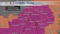


CARTERVILLE (WSIL) -- An Excessive Heat Warning has been issued for the entire viewing area until 9PM this evening. Heat indices have climbed above 110 this afternoon. Use caution when outdoors and drink plenty of water.
A cold front is moving through from the northwest this afternoon. However, the relief will be minimal and not noticeable until Thursday. Along the front there is a chance for isolated to scattered storms. The best chance is along and south of the Ohio river. If storms do develop, they could be on the strong side with heavy rain, lightning and gusty winds.
Convection will begin to diminish overnight, with mostly clear skies returning. Overnight lows will dip into the upper 60s and low 70s.

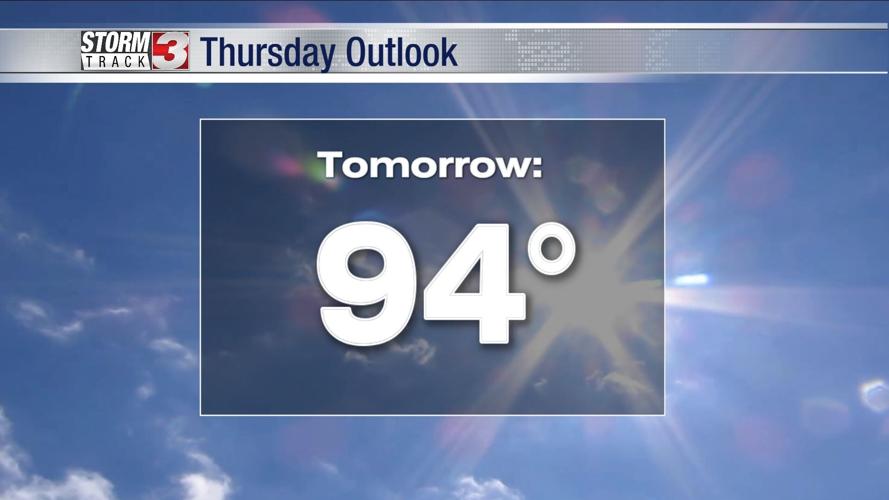
A less humid air mass will settle in Thursday with a slight dip in temperatures. Afternoon highs will still climb into the mid 90s but it won't be as oppressive. That relief is short lived. Heat and humidity crank back up this weekend, with many areas projected to hit 100 degrees.