

CARTERVILLE (WSIL) -- Our frontal boundary has dropped south, taking the rain further south as well. It has been a fairly mild day, with temperatures only climbing into the 80s. A few isolated showers and storms can't be ruled out in southeast Missouri and western Kentucky this evening.
Our next wave will move in Saturday and will then stick around throughout the day. The focus for rain will still be southeast Missouri, western Kentucky and far southern Illinois, but a stray shower is possible further north.
Despite the chances for some rain Saturday, it will end up being the drier day this weekend. Our front will begin to move back to the north Sunday, bringing widespread scattered showers and storms to the whole region. Heavy rain, lightning and isolated gusty winds will be the main threats with any storms.
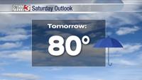
If you're trying to squeeze in outdoor activities or mowing, Saturday is your best bet. Thanks to the front, clouds and rain, temperatures will stay below average. Highs through the weekend will top out in the low 80s.
The break from the heat is short lived. The dry and hot weather is still expected to return next week.