

WSIL(Carterville, Ill.) -- This evening, we are tracking temperatures that are in the low 70s to low 80s across the area. Skies are mostly cloudy, with winds that are out of the west at 10 to 20 miles per hour.
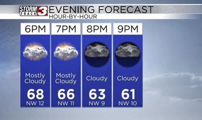
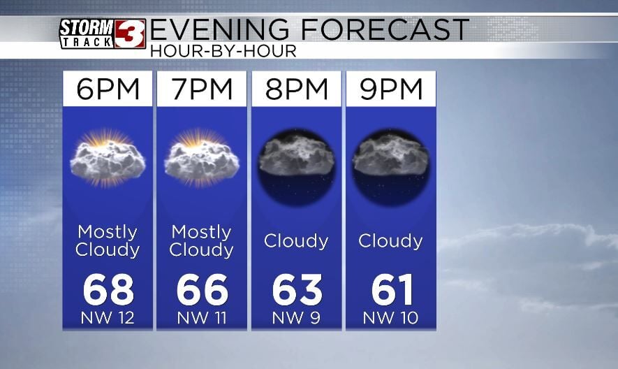
This evening, a mostly dry cold front will track through the area from northwest to southeast. Along it, a stray or isolated shower is possible. But most locations will remain dry. The most likely areas to see showers will be near the Kentucky/Tennessee state line, between 6 PM and 11 PM. Otherwise, temperatures will be warm, in the mid to upper 60s.
Once the front passes, we will see temperatures drop. Morning lows tomorrow will be in the low to mid 40s across the region, with winds that will be out of the northwest at 10 to 20 miles per hour. Skies tomorrow will be mostly sunny through the whole day, with high temperatures that should hit the low 60s.
A more active pattern is expected Wednesday through Sunday, with several chances for storms. However, the risk fr strong to severe weather looks minimal. But, we will have to watch Friday closely.