


WSIL -- Happy Independence Day!

A few stubborn showers this morning persist in western Perry County and Randolph County. These will not likely last too long this morning, but there will be more chances for scattered storms this afternoon.
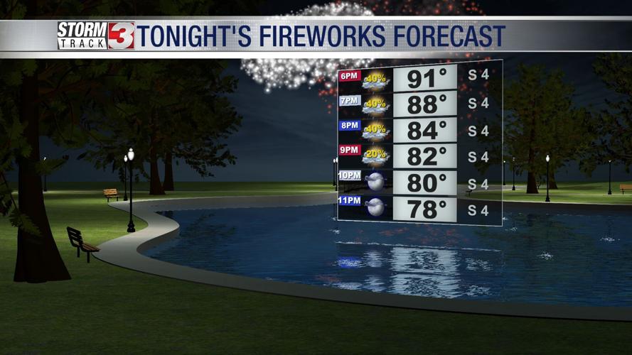
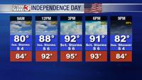
The muggy air has returned, combined with temperatures in the lower 90s this afternoon, heat indices will push into the mid to upper 90s.

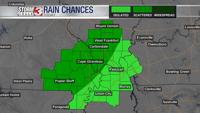
Scattered showers and storms are likely to develop during the heat of the day, primarily across southwest Illinois and southeast Missouri. Heavy downpours and lightning will be the biggest threat with severe weather not anticipated.

Fireworks tonight should not have too many issues with rain chances fading away rapidly around sunset.
Wednesday will be another hot and humid afternoon, but a cold front approaching from the north will likely fire off more scattered showers and storms. Some of these storms could be strong with hail and isolated strong winds being the main threat.
Some showers may linger into Thursday, especially across the Missouri Bootheel and western Kentucky, closer to the slow moving cold front.
In the wake of the boundary, temperatures will drop out of the 90s and into the upper 80s through the end of the week.