

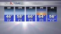


WSIL -- Cold this morning with temperatures dipping into the mid to upper 30s overnight. A few rural areas are even experiencing temperatures around the freezing mark with patchy frost.

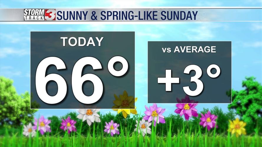
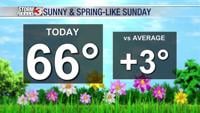
This afternoon, sunshine and south winds will kick in, pushing temperatures back into the mid to upper 60s. The south breeze could gust 15 to 20 miles per hour.
A weak disturbance will move across the region late tonight and into Monday morning. This will bring the next chance for a few scattered showers. The best chance for rain will be along the I-64 corridor with a few rumbles of thunder also possible.
Any lingering rain will move out by lunch time on Monday with another very warm afternoon, highs will peak in the lower 70s.

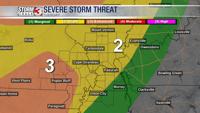
Attention then turns to Tuesday and Wednesday. Temperatures Tuesday afternoon will climb to around 80º. By Tuesday evening, a few storms are possible. Any storms that develop could be strong or severe, but there is still uncertainty on if storms can develop. The Storm Prediction Center has much of southeast Missouri in a Level 3 (out of 5) "Enhanced" risk. Southern Illinois is in a Level 2 (out of 5) "Slight" risk.
The better chance for storms will be Wednesday morning with a cold front sweeping across the region. Some of these storms could be strong again.
Warm air will hold on through Wednesday, but temperatures will trend colder towards second half of the week with highs only in the 50s Thursday and Friday.