

WSIL -- The storms have ended and a cold front is settling south of our region this morning.

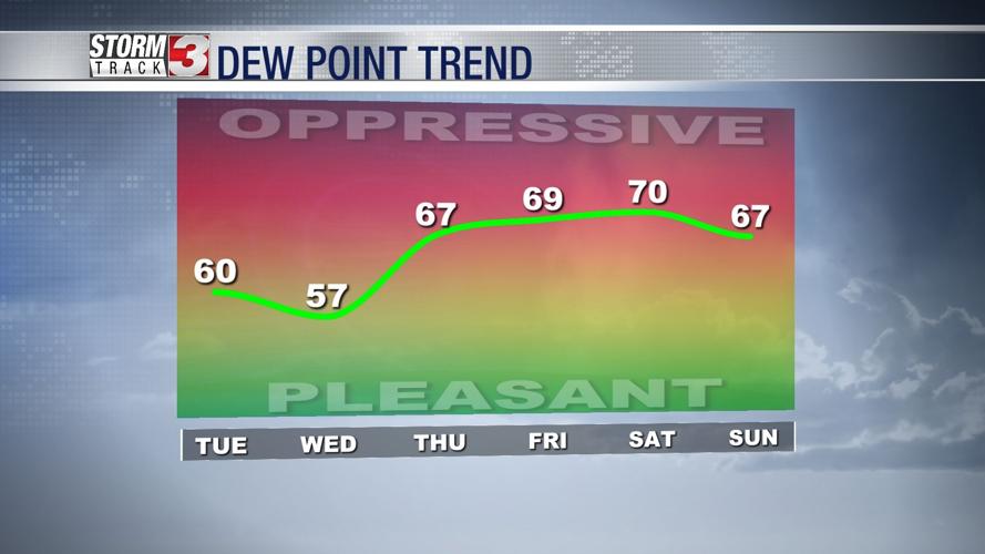
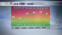
In the wake of the front, slightly cooler and notably less humid air will filter in from the northeast.
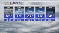
This afternoon, high temperatures will be in the upper 70s in southern Illinois with lower 80s common across parts of the Bootheel and western Kentucky.
Humidity levels will remain lower through Wednesday, but the boundary will lift back north later this week, bringing the mugginess back by Thursday and Friday.

As humidity levels surge, so will the chances for more showers and storms. Similar to the last few days, it will not likely be all day rain, but more scattered storms from time to time with heavy rain, lightning, and occasional strong storms. This threat will continue into the weekend.