


WSIL -- Plan extra time this morning to scrape the windshield, there is a lot of frost on windshields.

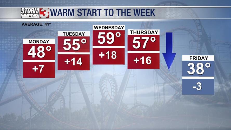
Temperatures in the lower 20s to start the day, but sunshine and a light breeze from the south will push afternoon highs in the upper 40s this afternoon.
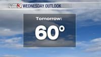
Temperatures will continue to stay above average through midweek with highs near 60º by Wednesday afternoon.

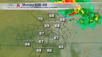
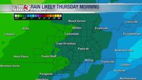
By Wednesday evening, a storm system will track from the Plains into the Midwest again, sending more rain our way. The heaviest rain is expected early Thursday morning and a little thunder and lightning is possible.

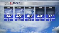
Thursday morning will remain warm with temperatures in the upper 50s, but as the cold front sweeps through the region, readings will drop back into the upper 30s by the late afternoon.
Friday will be a cool, blustery day with highs only in the 30s.