
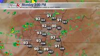

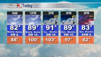

WSIL -- Monday will be the hottest day of the week with afternoon temperatures in the lower 90s and the humidity pushing the heat index as high as 105º.

During the heat of the day, a few hit & miss storms are possible. While pinpointing exactly where these storms will develop, it appears the highest chances will be near the I-64 corridor where moisture will be pooling ahead of an approaching cold front. Severe storms are unlikely, but blinding rain and frequent lightning are possible with any storms that develop.

The cold front will move into the area Tuesday, bringing the highest chance for scattered storms this week.

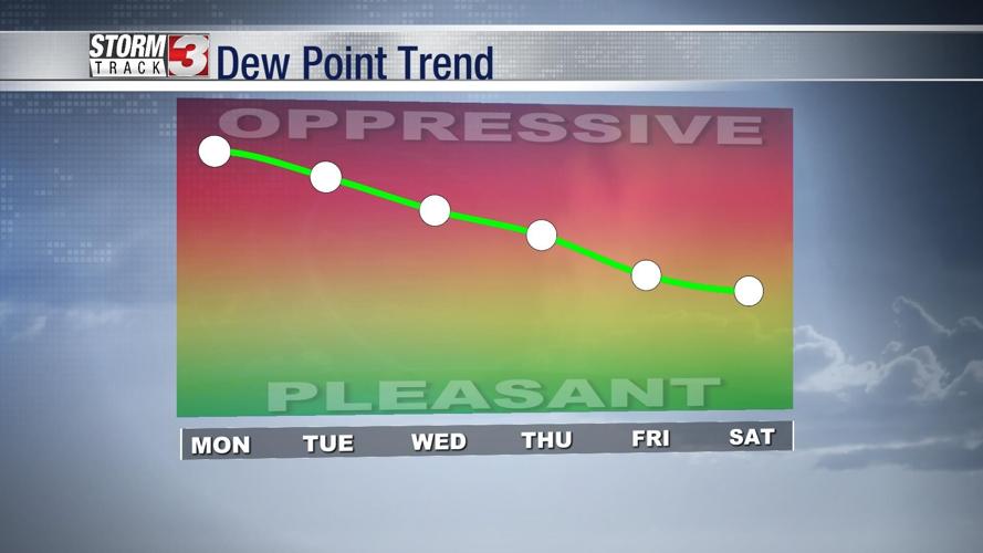
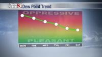
Eventually, this cold front will move through the area on Wednesday. By Thursday and Friday, the cooler, less humid air will begin moving in!