

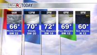


WSIL -- It's very warm already this morning with temperatures in the mid 60s, and south winds will push highs into the lower 70s by this afternoon.

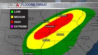
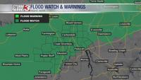
A Flood Watch will go into effect tonight at 7 p.m. for southern Illinois and southeast Missouri and go until 1 a.m. Saturday morning.

While much of today will be dry, as a cold front approaches from the north this evening, rain will quickly begin to increase across Illinois and Missouri. Showers and storms are likely to gradually track east and southeast through much of the night. The heaviest rain will fall across southern Illinois and southeast Missouri from around Fredricktown to McLeansboro with 1-2" by sunrise Friday morning.
Rain will likely continue much of the day on Friday, but will be lighter throughout much of the daylight hours as the stalled boundary settles near the Kentucky/Tennessee state line.

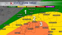
Friday evening, the boundary will lift back north as low pressure approaches the region. Storms are likely to gain intensity across southeast Missouri and shift east into Illinois and Kentucky through the late evening. In addition to more heavy rain, a few severe storms are possible. Right now, the biggest threat appears to be across western Kentucky and northwest Tennessee with damaging winds and a tornado or two possible.

By midnight Friday night, the strong storms will be track out of the region to the east, but a few showers may linger into Saturday morning.

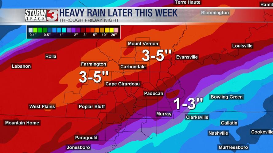
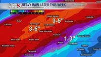
3-5" of rain is expected across much of southern Illinois and southeast Missouri through Saturday morning. Amounts will taper down to 1-2" farther south. Significant flooding is possible.