


CARTERVILLE, Ill. (WSIL) -- Cool temperatures continue to filter into the region. Luckily, we are still staying with rain, rather than snow.
It may be a while until you get those sunglasses back out. Conditions will remain fairly cloudy.
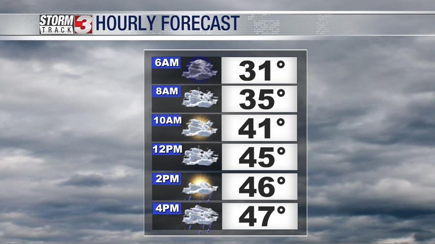
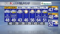
Saturday: Isolated showers are expected to move through parts of southeastern Missouri this morning. Towards the late morning, showers will increase eastward over the region. Scattered to widespread showers are expected through the evening hours. High: 47. Low: 39.

Sunday: DAYLIGHT SAVING: Early morning showers will be possible as a system moves out of the region. Mostly cloudy and staying cool. High: 48. Low: 29.
Monday: Cool morning with potential of some frost as morning temperatures dip into the mid to upper 20's. Mostly cloudy. High: 42.

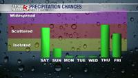
Temperatures are forecast to stay into the mid 40's to lower 50's through the rest of the week, with the exception of Thursday when we are tracking our next chance of rain.
The week looks dry up until late afternoon Thursday going into the early morning hours Friday.