


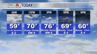


WSIL -- An upper-level disturbance is bringing a few light showers to areas near the Kentucky & Tennessee state line early this morning. Farther north, rain is NOT expected in southern Illinois or southeast Missouri.

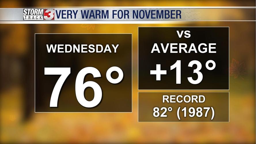
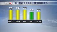
Clouds will begin to exit for most around midday and set the stage for a very warm afternoon. High temperatures will be in the mid 70s today and likely climb to the upper 70s Thursday and Friday.

A large storm system will track out of the Plains into the Upper Midwest Friday night. This will bring a surge of moisture northward, leading to a good chance for widespread rain. Forecast models have been continuing to move the timing earlier, which means the rain may now make it into our region late Friday night with the heaveist expected Saturday morning.
0.5 - 1.0" looks fairly likely Saturday. Rain will exit by Sunday, but mild weather will remain.


