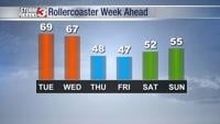

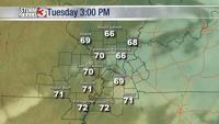


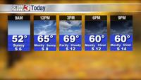

WSIL -- Jackets needed to start the day, but you may want something lighter underneath as temperatures will soar into at least the upper 60s Tuesday afternoon.

The caveat in today's forecast is cloud cover. If we see low clouds develop over western Kentucky and southeast Illinois, temperatures could be kept down into the low to mid 60s. Areas with sunshine will close in on 70º.

Winds will become stronger overnight from the south as a cold front begins to approaching.
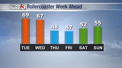
Mid to upper 60s are still expected through midday Wednesday, but a strong cold front sweeps through Wednesday evening. This front will likely also bring showers, especially along and behind the front.

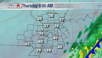
The rest of the week is much colder with highs only in the 40s Thursday and Friday.