

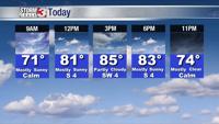


WSIL -- Watch for patchy fog Friday morning, primarily in rural areas.
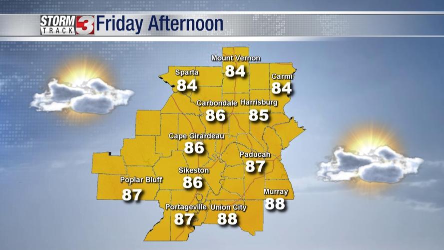
Fog will mix out quickly after sunrise as temperatures quickly begin to warm up. By this afternoon, readings in the mid 80s will be common, but the humidity will be fairly tolerable for mid-August.

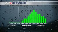
There will be a lot of dry time this weekend, but as a cold front approaches from the north Saturday evening, chances for scattered storms will increase. While not everyone will see rain, a few pockets of heavy rain along with scattered lightning will be possible.

By Sunday, the cold front will be moving south into western Kentucky and the Missouri Bootheel, likely shifting most of the rain chances south as well.
Slightly cooler, less humid air will begin moving in from the north, leading to a fairly pleasant start to the work week on Monday.