
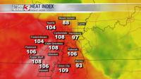


CARTERVILLE, Ill. -- Overall, temperatures have warmed up nicely for the afternoon with high temperatures into the upper 90s and even some low 100s. When the humidity is factored in though, it feels more like the upper 100s, with the heat index being at 108-110 in a few spots.

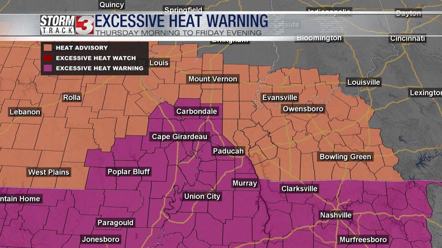
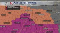
Much of the region is under some kind of heat alert, with the counties in purple being in an excessive heat warning and counties in orange being in a heat advisory. Regardless of whether you are in an excessive heat warning or a heat advisory, be on alert for much hotter than average temperatures and the signs of heat exhaustion.
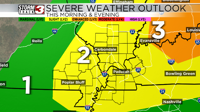
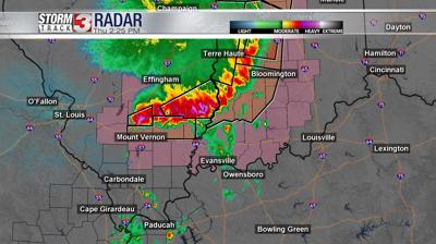
Unfortunately, these warm temperatures are not the only weather threat we're tracking for tonight. The storm prediction center has placed most of our region under some type of risk of severe weather. The western counties in Missouri (west of Cape Girardeau) are in a level 1 out of 5 risk, and the threat increases to a level 2 out of 5 around Carbondale, and a level 3 out of 5 in eastern Illinois east of I-57.

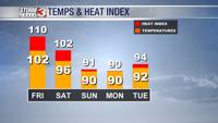
Tomorrow, temperatures will heat up again to similar temperatures with the air temperature expected to hit 102 and the heat index reach 110 by tomorrow afternoon.
The high temperatures will stick around on Saturday, with relatively cooler temperatures on Sunday, Monday, and Tuesday.