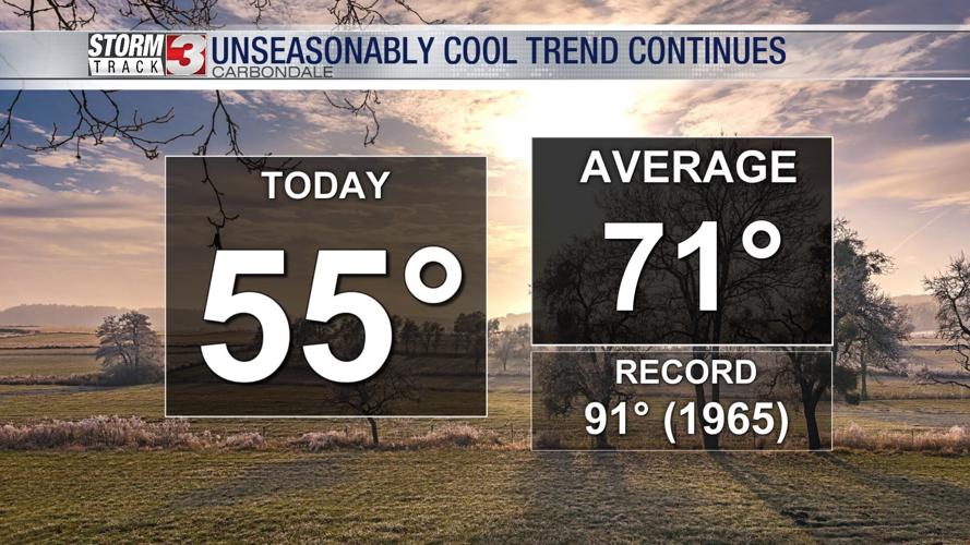


WSIL (Carterville) -- We’re ending this weekend and April as a whole on a pretty chilly note. Sunshine is peeking through the partly cloudy skies making it feel a bit more pleasant outside. Even with that help, temperatures will only climb into the mid 50s thanks to a Canadian high pressure.

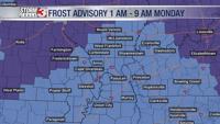
Overnight will be another cold one with lows in the mid 30s. We have yet another Frost Advisory in place beginning at 1 AM tonight until 9 AM Monday morning but this time it's for everyone. There is also a slight possibility of this turning into a freeze warning so continue to keep your sensitive plants safe and make sure the kiddos are bundled up at the bus stop.

High pressure stays in place for the start of the work week, keeping us fairly clear and cold. We stay roughly 10 degrees below average with highs tomorrow in the low 60s.

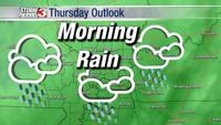
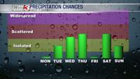
Our dry streak ends Tuesday as a fairly complex unsettled pattern returns. There’s a slight chance of rain Tuesday evening but we’ll see the better chance for precipitation Wednesday night into Thursday.

Our temperatures struggle to warm up all week as we stay well below our ‘normal�� high of 70 degrees. Make sure to keep an umbrella and a warm coat around.