

CARTERVILLE (WSIL) -- Scattered showers have returned this afternoon, ahead of a cold front. The rain will ramp up this evening and overnight as the front move through our region. While no severe weather is expected, a few rumbles of thunder are possible. Rain totals are still expected to be between 0.5"-1.0", with isolated higher amounts.
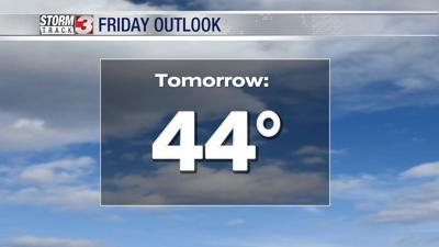
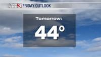
Light showers will linger into Friday morning, primarily in our eastern counties. Once the front is east of our area, much drier air will settle in. Most of the day will end up being dry but chilly. Winds will shift out of the northwest with high temperatures dipping back into the 40s. Grab a jacket.
The sunshine will be back by the weekend but it will be cold. Winter will go out with a bang. High temperatures both Saturday and Sunday will only top out in the upper 30s and low 40s, with lows in the 20s. With multiple hard freezes expected, you may want to protect any early blooming plants.
Spring officially begins Monday!