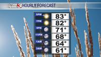
Carterville Ill. (WSIL) -- Certainly feels like summer out there today! temperatures climbing into the mid 80s across the area. You are a bit cooler down south across western Kentucky and NW portions of Tennessee as clouds have really been hanging around along those areas today. Across the other parts of the area we are seeing a lot of sunshine but some decent cumulous clouds popping up. These eventually could lead to some thunderstorm activity as we head towards the evening. For many of us though we should remain more dry than we previously expected.
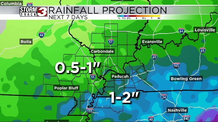
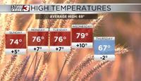
Over the coming days we should continue to see those isolated chances for showers and storms to crop up just as they have today. Keeping enough cloud cover around to keep our temperatures around the mid and upper 80s. Overall the majority of the area is looking at about a half inch to and inch of additional rain over the next week. Not a tremendous amount due to the sporadic nature of the storms but of course if you find yourself lucky enough to come under a few of these you could rack up closer to 2 inches or so.
As we head towards the weekend I see more opportunity to see our temperatures heating back up towards the 90s. This will come with showers and storms as well, potentially more expansive than we have seen recently. This will also however bring those heat index values back towards the triple digits as we head towards next week.