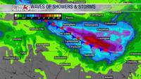


CARTERVILLE Ill. (WSIL) -- The off and on rain will stick around overnight, as the cold front continues to move through. An isolated strong storm can't be ruled out but the chance is low.
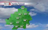
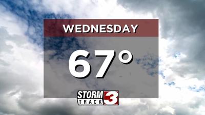
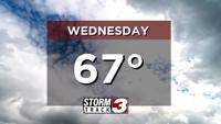
Wednesday will bring much drier conditions for most of the region. A few showers will linger for western Kentucky and northwest Tennessee, while southern Illinois and southeast Missouri will dry out. High temperatures will be warm but cooler, topping out in the mid to upper 60s.
Another chance for showers will build in from the southeast late Wednesday and into Thursday, before drying out again Friday. The active weather doesn't end there, more rain and a few storms are expected through the weekend. Hang on to the umbrellas.
Overall, temperatures will remain above average. Highs will top out in the mid to upper 60s through the week.