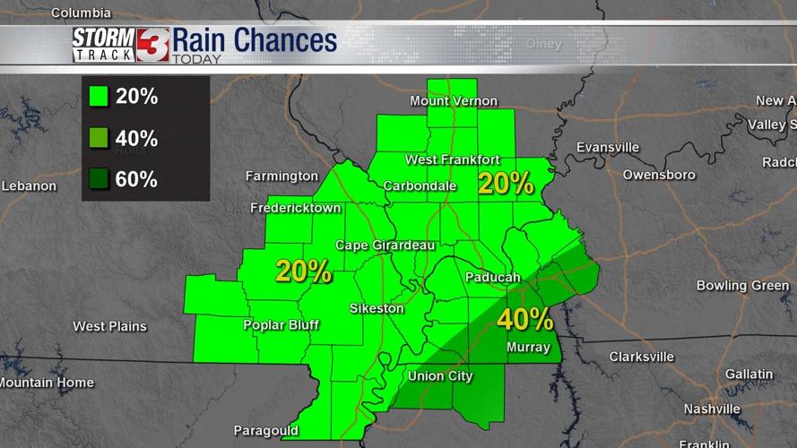


WSIL -- The remnants of Hurricane Ida are passing through northern Mississippi and central Tennessee this morning. The northern edge of the large shield of rain is just clipping parts of Calloway County in western Kentucky.

Farther north, rain chances will be lower today, but a few pop up showers are still possible during the daylight hours, mainly during the heat of the afternoon.

Clouds will likely keep temperatures from warming much, with highs in the lower 80s, but the humidity will continue to run high.

By tonight, Ida's remnants pass east and a cold front begins to slowly move in from the north. This front will drop the humidity throughout the day on Wednesday and set up a nice break from the heat through the end of the week.