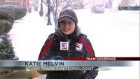
January 9th evening forecast with Meteorologist Nick Boynton
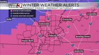
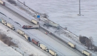
CARTERVILLE Ill. (WSIL) -- Our winter storm is approaching from the south and west tonight. SEMO will be the first area to see snow fall around 10pm - 12 am tonight. That snow will continue to move north and east across the rest of the forecast area through 5am. Since temperatures have remained primarily below freezing across much of the area, the snow will immediately stick as soon as it starts falling. This will lead to highly dangerous driving conditions throughout the day tomorrow and into Saturday.
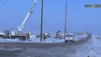
This event is different from our last one where ice is not a concern with this system. Good news is we stay all fluffy with our snow which should help limit the power outage threat. The only thing I worry about is the trees that still have ice on them may be able to grab a bit more of that snow and that could add some weight. We will go with generally isolated power outages expected at this time.
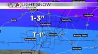
Expect a widespread 4-6 inches of snow across the entire area. Highest amounts will be towards the south and lower amounts towards the north. Still, this will be the most widespread snowfall event we have seen since February 2021! Stay warm and stay safe!