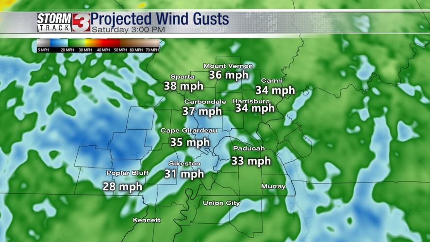


WSIL (Carterville)-- Another dry and unseasonably warm day to begin the weekend but conditions are expected to change soon. Temperatures are forecasted to reach into the lower 70s, well above our typical high for the beginning of March. Most notably today are wind gusts, with areas seeing upwards to 35 mph gusts this afternoon/evening, into tonight.

Our first chance of rain will begin tonight around 10 PM as a slight chance of showers and thunderstorms are expected ahead of a cold front. Temperatures tonight will remain mild, falling into the mid 50s.

Sunday is expected to be more active with scattered showers off and on for most of the day. Temperatures still remaining mild, with highs in the upper 60s.

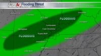
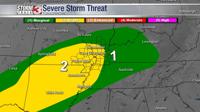
The strongest part of the storm will be Sunday night into Monday morning. Heavy rainfall with a few stronger to severe spots, as well as a brief tornado or two, can't be ruled out. Flooding issues are a concern due to the heavy rainfall. Stay weather aware the next few days.