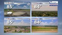

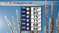


WSIL (Carterville) -- It's a beautiful start to the work week with blue skies, sunshine and warm temperatures with highs today in the upper 80s. It's a lot less humid which is a nice refresher for July.

If you have any plans tonight or were just debating about any outdoor activities, you're good to go! Overnight we'll fall into the mid 60s and clear skies will stick around.

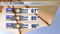
Tuesday is basically a 'cut and paste' of today with temperatures a few degrees warmer in the low 90s. Humidity should still be on the comfortable side and sunshine sticks around.

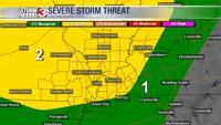
Wednesday continues to be the day to watch. We see a pattern shift as a warm front lifts from the south, driving dew points back to the mid 70s. A few strong to severe storms may form out of this. There's still a lot of question in exact location and timing, but large hail and strong winds continue to be a concern.

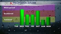
Enjoy today and tomorrow because once the rain returns, we have a hard time shaking it. Scattered storm chances stick around through the end of the work week and to start the weekend. As we grow closer to these days, more details like timing should be clearer.