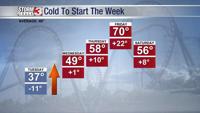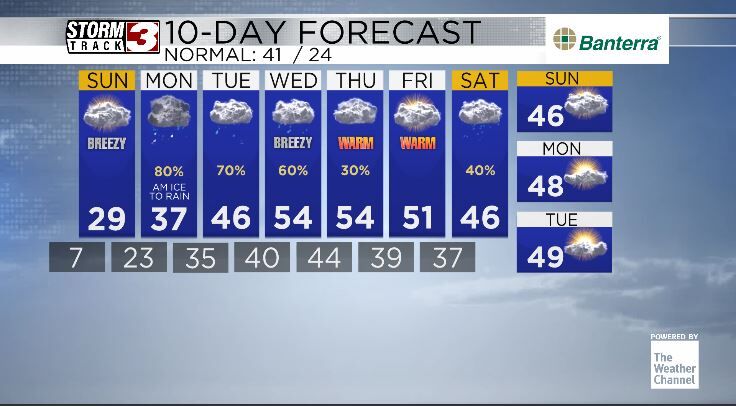


Carterville, IL (WSIL) -- Enjoy the sun while you can still see it today and on Sunday as a very unsettled pattern approaches for your new work week.

We are clear and cold for tonight into tomorrow as clouds begin to build in from the west. Cold arctic airmasses are fairly tough to move so I do expect that locations along the Illinois-Kentucky border and to the NW will experience an initial period of sleet and or freezing rain for your day on Monday. Even if amounts remain light, (as we expect them to be) any amount of ice is very dangerous for travel. Make sure you are keeping a close eye on the forecast as we get closer to Monday.
After that everyone should turn over to a miserable cold rain that remains on and off through the entire week.
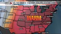
On the bright side, high temperatures after Monday get into the 40s and even 50s as we head towards the end of the week and low temperatures remain above freezing.
Overall, cold and calm until an early icy mix on Monday starts our very unsettled but much warmer week ahead.