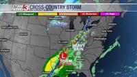
CARTERVILLE Ill. (WSIL) -- Tonight: A cold front moves through tonight giving the area the next best chance at showers. This is a fairly weak cold front overall. So we aren't expecting heavy rainfall amounts or any severe weather across the area. Some thunderstorms could develop through the evening across western Kentucky but all should be below severe limits.
Thursday: Clouds will clear across the area. Another couple days of spring in store as sunshine takes over the area again. That cold front only bringing temperatures down into the mid to upper 50s. With full sunshine its going to feel amazing out once again. Breezy at times with winds around 10-15 mph.
Weekend: A dry cold front moves through Friday night and cools our high temperatures down for the weekend into the 40s. We should still remain dry though with partly cloudy conditions.