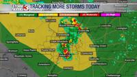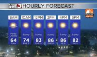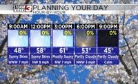
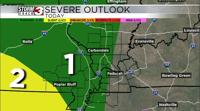


Carterville Ill. (WSIL) -- Another warm day on tap for our area with many of us making it into the upper 80s for high temperatures. The humidity has come back as well so that means an increased chance for afternoon showers and storms. Overall, these look to be slow moving pulse like thunderstorms. This means they will be slow moving heavy rain makers and not everyone will see a storm. There is a level 1 risk for severe storms so some strong winds and small hail could accompany the storms that do form.

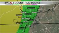
Bigger threat from the storms would be the heavy rain and flash flooding threat. We have an elevated flood risk for today and that due to the slow moving nature of the storms. They will dump some heavy rain fast and the entire area has had plenty of rain over the past month so any additional rain could cause flash flooding concerns.
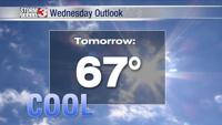
Tuesday we have a similar situation but most likely less coverage and less instability so primarily an isolated heavy rain threat then before a more widespread chance for storms late Tuesday into Wednesday arrives. Should have a line of thunderstorms move through with a cold front to hopefully cool us down a little and shut off the water for a couple days across the area. Severe threat looks low since instability and shear look fairly weak!