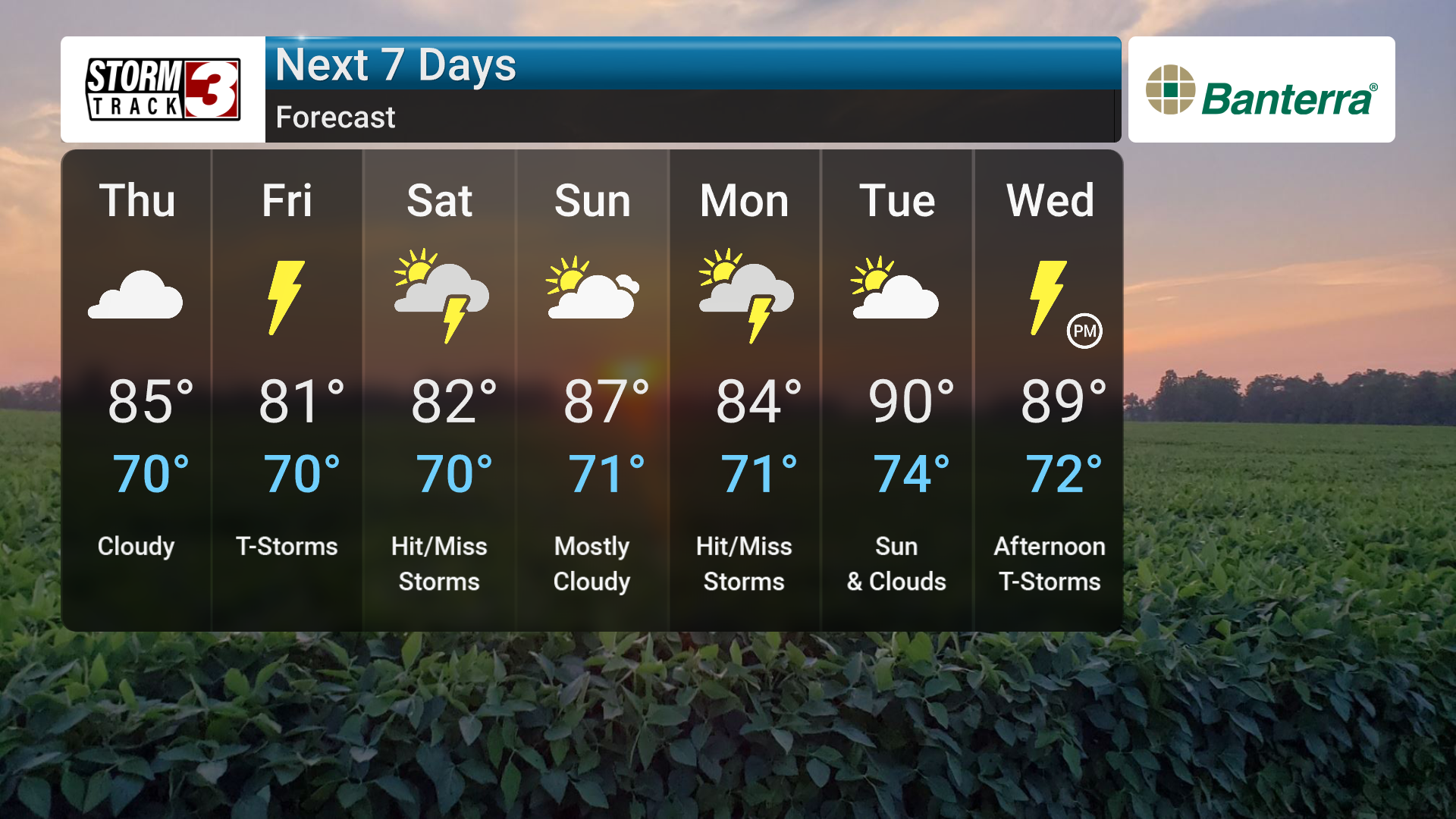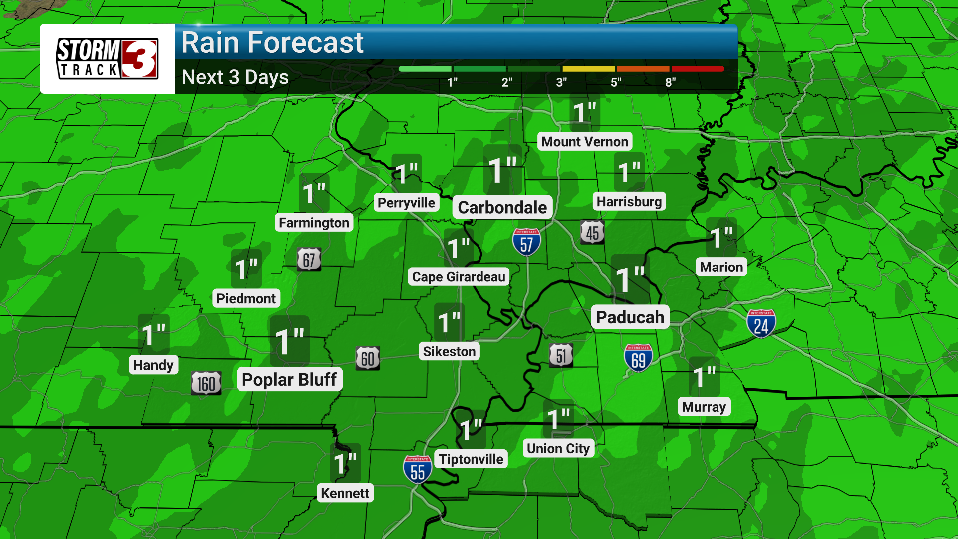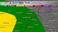


An upper-level disturbance moving out of the Southern Plains will trigger showers and thunderstorms across the Mid-Mississippi River Valley through the weekend. As high pressure shifts eastward, southerly surface winds will increase humidity levels, creating a more summer-like feel.
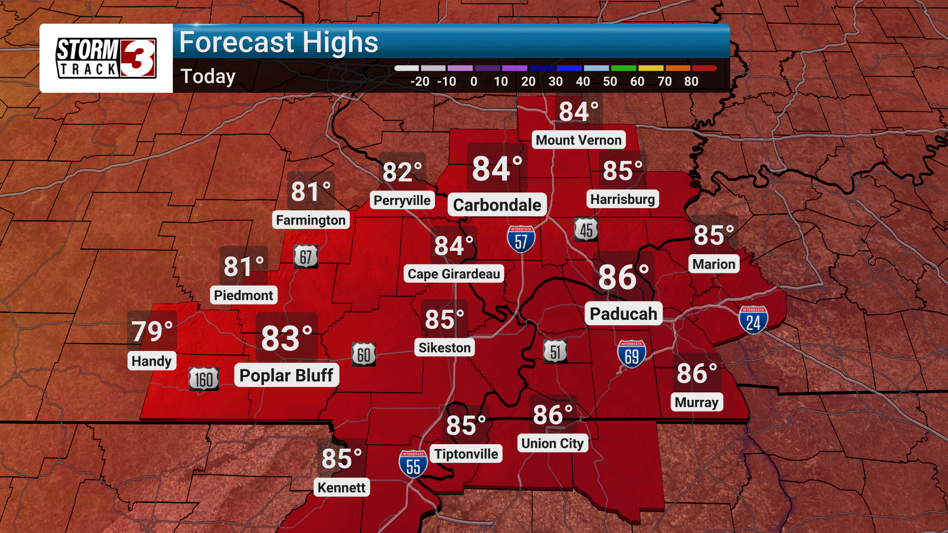
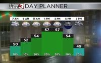
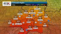
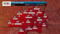
The combination of increasing humidity and the approaching disturbance will lead to elevated rain and storm chances, particularly on Friday and Saturday. While temperatures will be near normal today, slightly cooler conditions are expected Friday and through the weekend due to increased cloud cover and rain.
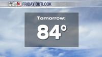
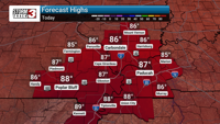
While temperatures cool down slightly for the latter part of the week, we will see temperatures climb by the middle of next week. As another disturbance moves in next week, this unsettled pattern of showers and storms is expected to persist, with high temperatures possibly reaching the lower 90s by the middle of next week. This means heat indices will rise to around the century mark.