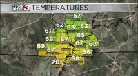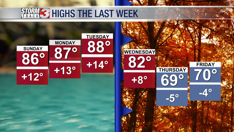


WSIL(Carterville, IL)-- After an above average week, most of us this morning are waking up to temperatures in the low to mid 40s this morning, which is well below our average this time of year.

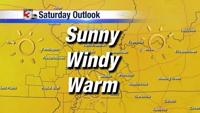
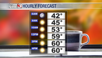
As we go throughout the morning, we are tracking sunny conditions. Winds could be gusty at times this morning, with peak wind gusts of 10 to 15 miles per hour possible. Temperatures will warm through the the morning, to the mid-50s by about 10AM, and to about 60 by lunchtime. Sunny skies will last through the afternoon and evening, as we are tracking highs today of around 60 degrees, though a few spots may not make it out of the 50s.
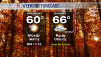
Clouds will be increasing overnight. We are tracking cooler temperatures to start the day tomorrow, with overnight lows likely in the upper 30s.

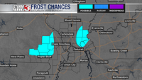
There is the possibility of patchy frost tomorrow morning, mainly in low-lying areas of southeastern Missouri and southeastern Illinois.

Partly cloudy conditions will last through the day on Sunday, and we will see warmer highs tomorrow in the mid 60s. Late tomorrow evening, a stray shower is possible over southern Illinois.
Looking towards the start of the next work week, temperatures will remain in the 60s for the first half of the week before a warm front lifts to the north on Wednesday and brings temperatures in the mid to upper 70s, as well as increased rain chances.