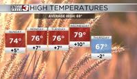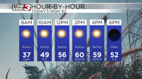


Carterville (WSIL) -- Very breezy today with a southerly wind bringing in a very warm airmass with temperatures across the region hitting the mid 70s. Paducah broke their record high today of 73 with a high temperature of 74 so quite an impressive warm airmass we are seeing.

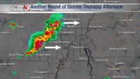
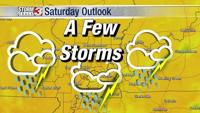
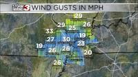
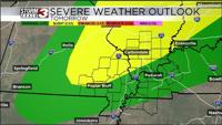
The cold front is approaching for Tuesday and that means our winds will also be increasing. The winds will be howling tomorrow which is why we are under a wind advisory all day tomorrow for wind gusts potentially reaching 40 mph at any point tomorrow. The winds will be especially strong as the cold front approaches overnight around 12-3 AM across our area. This is also the best time we will see the chance for strong storms. They look like they will remain fairly isolated but the ones that do develop could be quite strong to even severe.
The storm track 3 app will be nice to have handy so that if any warnings do happen over your backyard you will get a warning directly to your phone.
Temperatures will be in the 70s again for Tuesday but will crash on Wednesday and everyone will wake up with it feeling like winter!