


WSIL -- Wow! Temperatures this morning are warm for early March! In fact, many are waking up to readings that are warmer than the average high temperature this time of year!

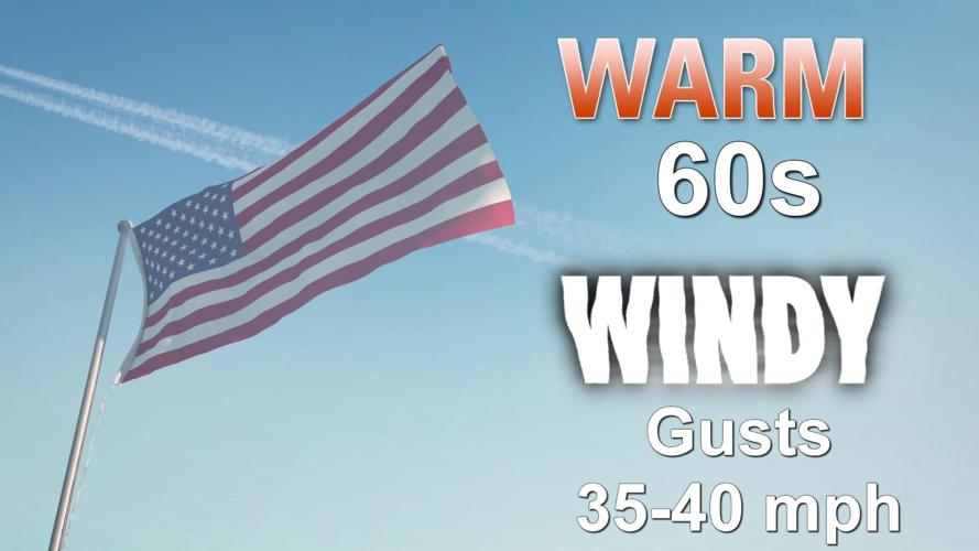
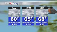
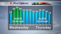
Warm and windy. That sums up Wednesday's forecast. Temperatures during the afternoon will warm into the upper 60s and winds will even be STRONGER than Tuesday. Gusts from the south could top 35 miles per hour.

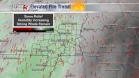
Despite a bump up in humidity levels, strong winds will keep the elevated fire threat in place for one last day. Burning brush and leaves is NOT recommended.
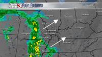
The fire threat will go DOWN as rain chances ramp up Thursday and Friday.

Showers will be somewhat hit and miss Thursday, but chances will be increasing during the afternoon and evening as a cold front approaches from the north.
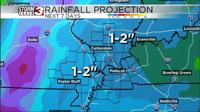
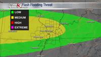
It appears the heaviest rain will fall from late Thursday night through Saturday morning. Rain amounts are likely to be highest across southern Illinois and southeast Missouri where 1.5-3" is possible through the first half of the weekend.

Another big system is set to roll through the Midwest Sunday night into Monday bringing MORE rain and a few t-storms.
Meteorologist Nick Hausen has the latest breakdown on News 3 This Morning! We've got you covered!